This ramble may be divided into two stages - 2 days stay in Wałbrzych to visit one end of the trial. The rest of the trial can be done by excursions from Jelenia Góra, which may be joined together with wandering in Sudety Mountains (the Sudetes) - with Karkonosze Mountains range known as a good centre for winter sports - with their skiing resorts becoming a budget alternative to the Alps.
While staying in Walbrzych, you can get a bus to Grodno Castle and start your trip. This first part of The Piast Castles Trail is 25.3 km long - you should be able to finish it in 6.5 hours, though that doesn’t include time spent on wandering around castles or visiting the interiors. It may turn out that you need another day for visiting Książ Castle itself due to its size.
Grodno Castle

The oldest events relating to the castle’s history are not known. Oral tradition attributes construction of the castle to Boleslaw Wysoki (Boleslav the Tall) in 1198, with extension carried out by Bolko I, at the end of the 13th century. After the annexation of the Duchy of Świdnik-Jawor by the Czechs, the castle became the property of the Czech crown. From there it passed into private hands. Beginning in 1545 the castle was systematically extended, though during the Thirty Years War the castle was sacked by the Swedes, who largely destroyed it. The ensuing owners neglected the building, which gradually fell into ruin. They finally left in 1774. In 1869 the tower burned down due to lightning strike. Following WWII the building underwent several bouts of reconstructive works.
Today
Grodno represents a fusion of the Gothic style, as we can observe in the upper part, and a renaissance style visible in the lower extensions. The sundial built in 1716 presents an attraction for the visitor. Thanks to conservation works begun in the 19th century, we can today see a renovated tower and castle walls, where there is a restaurant with castle fare.
The entrance to the castle is paid - 9 zł.

Stary Książ Castle

The former name: Alt Fürstenstein.
Following the green trail, 18.3 km further (around 5 hours walk) is Stary Książ Castle (it’s around 1 km away from Walbrzych). Finding this site is very difficult, because it is hidden in the forest, and for the question about the castle the residents direct to Książ Castle. Through around 90% of the route the access to the castle is moderately gentle, but runs through the bumpy path, while the last 10% are the sharp climbs and descends.

Along green trail, some 2.8 km away (30 minutes), there is Książ Castle. This trip may be much shorter and cut to 10 minutes walk by using the black trail – which is not hard at all in this area.
Książ Castle
A former name: Fürstenstein

The Książ castle was built in the 13th century presumably on the initiative of Bolko I, however the first mentions of the castle come only from 1337. As early as the 14th cent. until the 16th cent. the stronghold was very often changing its owners. In 1509 it ultimately came into hands of the Hochberg family (who lost it earlier for a moment to the Schellendorf family) and since then until the World War II it was in their possession. These were exactly them who contributed in large measure to a present appearance of the castle making numerous reconstructions. In the time of the World War II the castle was a residence of military institutions, whereas under the castle the prisoners from the neighboring camp were forced to build tunnels. After the war the castle was devastated, and its reconstruction did not begin until 1966. The works lasted for a few dozen years and currently we can admire the castle in all its glory.

Take a virtual trip to see some of the places in and out of the castle. For the choice of trips, scroll down the website.
The entrance to the castle is paid – as the castle is huge, there are three thematic routs. Please, check the link for up-to-date prices.
And here is the official website


Cisy Castle
The next castle – Cisy Castle – is 4.2 km away from Książ Castle, which should take less than an hour walk.
A former name: Fröchlichsdorf, Zeisburg castle

The first reference to the Cisy Castle, also called the castle of Cis family or simply Cisy, originates in 1243. It was then presumably a wooden-earth defensive building, transformed into a brick castle at the turn of the 13th and 14th cent. by a duke of Świdnica-Jawor, Bolek I. After the death of a duchess Agnieszka, Bolko I’s successor – Bolko II’s widow, the stronghold came into hands of the Czech Republic and was the residence of the following families. The castle was destroyed probably during the Hussite wars, next it was quickly rebuilt, and in 1466 was demolished again. It did not discourage, however the then owners who rebuilt it again, and in the 16th cent. extended a defensive foundation. In 1643 the stronghold was destroyed by the Swedes, as to become again, at the end of the 17th cent. a property of the Czetryc family, who were one of the next families ruling over the castle after taking it over by the Czech Republic in the 14th cent. The last owner of the castle was in 1830 a landgrave of von Zieten family, to whom only ruins already belonged, since at the turn of the 18th and 19th cent. the authorities ordered to destroy the castle.
The access to the ruins is difficult and requires overcoming lots of rough terrain, steep climbs and lush brushwood. But after raining the access is even more difficult as you have to struggle through mud.

That would be the first group of castles on this trail. The next one is located around 16 km away from Cisy Castle and what I suggest is to either follow the trail – if you are a really keen on walking, or simply move to Jelenia Góra, which is situated in Jeleniogórska Valley, right at the bottom of Karkonosze Mountains (a traditional winter sports centre in Central Europe). By making the city your base for excursions you can finish visiting castles in the Piast Castles Trail to the east and north from the city, and also have some days-long trips in mountains, where finding a mountain shelter won’t be a problem – trails are really well signed (that does not mean you can forget about taking a map).
You can try your language skills and get to Jelenia Góra on your own (though finding anyone speaking English should not take much time, and if you speak German, that should be even easier), or you can leave it to us so you don’t need to be bothered with organizing a transfer.
Continouing your trip along The Piast Castles Trail let’s leave Jelenia Góra (following the green trail) toward Grodno Castle (the one from the beginning of this trip) and you will visit:
- Łomnica palace – 7.2 km (from the inter city bus station in Jelenia Góra; around 1.5 hour walk)
- Wojanów Palace (former castle) – 0.5 km (around 7 minutes walk)
- Sokolec Castle – 7.4 km (1 hour 40 minutes walk)
- Bolczów Castle - 5.3 km (1.5 hour walk)
Łomnica palace

The castle dates back to the 14th century. Starting in 1738 it belonged to the Manzel family. In 1800 they built a classical style structure, a few metres from the palace, called the “Small Palace” or the “Widow’s House.” After 1945 the large palace was furnished as a school, while the smaller building became the head offices of the local trading company, PPH Wojanow. In 1980 the large palace began to fall into ruin.
A small hotel and restaurant have been located in the “Widow’s House” since 1997. In addition, regular cultural events have been taking place here as well as in the large Palace of Łomnica, since 1999. These events include: exhibitions, readings, concerts, seminars, conferences, the circulation of folders and public information as well as consultation and activities aimed at supporting local historical buildings. The Stowarzyszenie Pielegnacji Kultury i Sztuki Slaskiej (Association for Preservation of Lower Silesian Culture and Art.) is active from the site.

The palace is around 11 km away from Jelenia Góra (about 3,5 hours walk) and though not included in the Piast Castles Trail, there is no need to trail off.
Wojanów Palace (former castle)
The palace in Wojanów arose in 1607 as the Renaissance mansion. Its construction was commissioned by Nikolas von Zedlitz und Nimmersatt. Several years later, during the Thirty Years' War the mansion was burned down by the Swedes. In 1667 it was rebuilt in a new style.

In the following centuries the building changed hands frequently, and was rebuilt many times. After the World War II, the palace was looted to become later the administrative building of the PGR (PGR - Państwowe Gospodarstwo Rolne, A State Agricultural Farm, was a form of collective farming in the People's Republic of Poland (created in 1949 and liquidated in 1991), similar to Soviet sovkhoz and to the East German Volkseigenes Gut). In 1995 it was bought by a private company, however the fire from 2002 thwarted the investment plans. Bought in 2004 by another company, the palace was rebuilt in the years 2005-2007.
Currently it houses the hotel, therefore the entrance is restricted, though asking about any available room and prices might be a good opportunity to have a look at a bit of interiors.


Sokolec Castle
Not much is left from the castle nowadays, which fell into ruin probably in XV century. Before the cstle was put up, there probably had existed a pre-Slavian settlement from VII century and the castle itself was constructed around 1207 by duke Henryk Brodaty, though first known documents mentioning the construction date back to 1369, when it was inherited.

In 1508 it was mentioned in documents as the castle in a state of ruin, probably since the first half of XV century, when it had been destroyed by Hussites.
Although there is not much to visit (just some stones, remains of probably the walls or one of the residential buildings),

climbing up Krzyżna Góra (Krzyżna Mountain) may give you an opportunity to see Jeleniogórska Valley and Śnieżka Mountain in Karkonosze. You may also try rock climbing in one of many places around Krzyżna Góra.
Bolczów Castle

Bolczów Castle (in German: Bolzenschloss) is located near Janowice Wielkie. Building of the castle is attributed to Clericus Bolcze (Mikołaj Bolcze), a courtier of duke Bolko II in the year 1375. Captured by Hussites, it was destroyed in 1433 by the punitive expedition of Wrocław and Świdnica burghers. Since the 16th century, the castle was owned by Justus Decjusz (Jobst Ludwig Dietz), a courtier of Sigismund I the Old. He reconstructed the ruined castle and developed copper mining in the surroundings. After Decjusz's death, the castle became property of the Schaffgotsch family. It was destroyed again during the Thirty Years' War, when Swedes, looking for its treasures, seized and burnt it in 1645. After this invasion, Bolczów Castle never regained its splendor, even though it was partly reconstructed in the 19th century.

Bolczów Castle is around 5.3 km away from Sokolec Castle and moving from one place to the oher should take up to 1.5 hour.


The next castles (located between Bolczów Castle and Cisy Castle) you can leave for another trip for the next castle is nearly 13 km away.
Instead, you can stay over night in Szwajcarka mountain hut, built in 1823 and offering now rooms for 2, 4, 12 and 14 people and price per night per person is between 20 and 25 zł, depends on a room. Meals are also served and the price range is from 4-6 zł for soups and bigos to 10 zł for Ruthenia dumplings (Red Ruthenia or Ruś Czerwona, a region formerly belonging to Polish Kingdom (until 1789), it’s where the name of these dumplings comes from).
Szwajcarka mountain hut is on the way up the Krzyżowa Mountain and you have probably passed it on the way to Bolczów Castle.

If you are not tired and ready to continue your walk, let’s turn south, to Karpacz, visiting some villages on the way (18.2 km):
- Karpniki – 2 km
- Bukowiec – 4.9 km
- Kowary – 4 km
- Karpacz – 7.3 km
Karpniki – a small village where you can find ruins of evangelical church in Karpniki

There is also a castle, unfortunately closed to anyone, not only tourists.


Bukowiec – another village with residential buildings typical for the region of Sudety Mountains...

... and ruins of an abbey, located a bit off the main road, in a forest.

Following the route you will enter soon Kowary, a small town with some more tourist attractions.
"Nowy Dwór" ("new mansion") palace. Erected in 1570 by the count von Schaffgotsch, remodeled in XVIIct. Around the mansion a very interesting park arranged in XIXct. Visiting it possible only after acquiring the owner's permission.

The palace itself has a long story. The building erected around 1570 Kasper von Shaffgosch for his younger son. The children of Kasper and his wife Anna von Siebental started three separate branches of the Schaffgotsch family out of which the Schwarzbach branch possessed the New Mansion until the Thirty Years War.
After execution of Hans Ulrich von Schaffgotsch in 1639 the property was purchased by count Prokop Czernin who descended from a very famous family - the Czernins. They were of the old Czech nobility. For centuries they belonged to associates of rulers, first Czech kings, then the Austrian Emperors. Originally their family town was Chudenice but becoming richer and richer they were buying many more estates. Probably in the late XV century a side line of them settled in Silesia. In XVII century they owned estates in Karkonosze including Kowary.
After Silesian Wars, in 1747, the mansion was purchased from the Czernins by the king of Prussia, Frederick the Great. At the beginning of XVIII century the kings sold it to the Kopsi family.

In 1820, because of an economic depression, it came to a division and sale of the Kowarian estate. The very mansion was bought by Henry LXXIV Reuss-Schleiz-Kosterlitz who in turn passed it to his son Henry IX. Henry IX enlarged the estate by purchase of former knights' lands comprising villages of Gruszków and Wysoka Łąka.
At the beginning of XX century the New Mansion was in ruin. Only in 1913 it was meticulously renovated. In the last year of First World War the duchess Feodora von Reuss designed some rooms of the mansion for wounded German officers.
The mansion was in possession of the the Reuss family until 1939. After Second World War it served as a rest house, then was held in lease by the health resort Cieplice and nowadays it is in private hands.
Lower Silesia Monuments’ Miniatures Park
In the area of Carpet Factory the "Miniatures Park of Monuments of Lower Silesia" has been made. The goal of this undertaking is to create a show-place as well as a new information centre of Euroregion Nysa. Visitors to this park have the possibility to acquaint themselves with some architectural structures of Lower Silesia (Dolny Śląsk) such as palaces, cloisters, churches, old centres of silesian towns etc minutely imitated precisely in the scale of 1 : 25.
These miniatures have been produced according to the newest technics from a weather conditions-proof stuff which makes them suitable for exposure in the open air. Much of green colour, a beauty of surrounding landscape, a very minute imitation of details, they all render the already beautiful monuments even more attractive. The evening floodlights of park together with the soundtrack put visiting Gulliwers in a most wonderful mood. The slogan of this place is "Smile because right for You we have created Your land of fantasy".


Entrance prices:
• adult: 17 zł
• seniors and students: 15 zł
• adolescent person with an older from 14 to 18 years: 13 zł
• kids till 14 years: 12 zł, up to 1 meter tall entrance free
And here are some pictures taken in the Old Town of Kowary.


Karpacz
Next stop is in Karpacz, a spa town and ski resort and is located at 480 to 885 metres (1,575–2,904 ft) above sea level. South of Karpacz on the border to the Czech Republic there is Mount Sněžka-Śnieżka (1,602 m).
The first settlements in area of Karpacz are noted by the official website of the city as being of probable Celtic origin and date to IV-III BC when they inhabited the region as part of gold digging taking place in the area. The first mention of permanent location within the current boundaries of the town is dated to the beginning of XV century and connected to destruction of village called Broniów, whose inhabitants moved to settle the area currently located at the altitude of town's railway station.

The settlement is mentioned in 1599 because of lead and iron mining. Since the construction of Krummhübel's first railway connection in 1895 history was connected with the development of metallurgy industries and with the progress of tourism. The village was part of Germany between 1871-1945. Krummhübel's German population was forcibly expelled from the village between 1945 and 1947. The town was subsequently repopulated with ethnic Poles and renamed Karpacz.
In Karpacz Górny a gravity hill is located where bottles appear to roll uphill. There is also a Norwegian stave church, moved here from Vang, Norway in the mid-19th century.
The Vang stave church (Świątynia Wang in Polish) was built at the turn of the 12th century in the south of Norway, in the town of Vang situated at Vangsmjösa Lake, hence its name. Around a thousand of such wooden churches were built in those days. Only 31 have survived in Norway and one is located in Karpacz Górny (former Brückenberg).

The Vang church follows the example of the best Scandinavian sacral wooden architecture, being a priceless work of old Nordic art. It was built to resemble a Viking ship, assembled with the use of only treenails and wooden daps, without any metal nails. The stave church was made of Norwegian pine, which is saturated with resin and therefore very durable. The external door frame with its characteristic attached columns is richly decorated with a tangle snakes and plants. Stylized lions stand upon the capitals, guarding the gates. It seems unthinkable that with so few technical tools in those days, including flintstone, bone and fishbone, it was possible to carve the detailed images of the lions’ heads, legs and hair. Contrary to the others, the lions have their heads turned outwards.
Place of a gravitational anomaly
When over 300 years ago Isaac Newton rested in an orchard and the famous apple fell on his head, he did not suspect that the law of gravity that he then discovered would have any exceptions.
Gravitation is common all over the globe. Everyone can feel its power by trying to carry a package weighing several kilos to the fourth floor.
However, there are places on Earth, where the laws of gravity do not seem to work as usual. An empty bottle or a can, spilt water, or a car with its engine turned off roll on their own, without any cause, up the hill. Such anomalies occur in different places of the world, in Australia, Barbados, Brazil, near Gold Hill in Canada, in the Gansu Province in China, Languedoc in France, Germany, Greece, Ireland, or near the summer residence of the pope at Lago Albano on Via del Laghi in Italy, even in Poland on a road leading up the hill of Żar in the Little Beskids. The Sudeten Mountains have got a few interesting and rare places as well.
In Karpacz, enthusiasts of unusual attractions will be interested in a section of Strażacka street, which leads toward Karkonoska street and the Dziki Waterfall. Going past the Piecuch Hotel, before the bridge on the Łomnica River, they will witness a remarkable phenomenon.
Observers think that the road goes gently downwards toward the Łomnica River. On this straight section of the road you can often see cars with their engines turned off, yet going up the hill, tourists spilling water that somehow goes upwards, just as bottles, balls or cans roll up the hill.

For many years, guides have been coming to this place with coaches full of tourists. They always ask drivers to turn off the engines and run at idle. To the astonishment of the tourists, the vehicle moves slowly and then quicker up the hill.
According to many scientists, it is just an optical illusion. The landscape around the hills, a curved horizon, and the way the trees grow, make us see the actually descending slope as a road upwards. No point of reference does allow us to assess the shape of the ground properly. Our sense of sight can even beat our sense of balance.
According to some research, there is a zone of anomalies on Strażacka street, where the gravity value is decreased by 4%.
So see it for yourselves, passers-by!
Dziki Wodospad
The Dziki Wodospad (‘Wild Waterfall’) is located near the lower station of the Kopa chairlift and was formed as a result of backwater on the Łomnica River. It is a place, where tourists like taking photographs against the background of water falling from a few meters.
The Łomnica is a wild mountain river, which has occasionally demonstrated its devastating force. In 1816 a cloudburst in the mountains resulted in massive destruction in Miłków and the entire Jelenia Góra Valley. The loss was estimated to be as high as 109,496 thalers. 28 years later, a gigantic avalanche went down into the cirque of Mały Staw, making ice crush and water flow out. The resulting wave, which carried ice floats, trees, rocks, stones and huge amounts of water, destroyed the watermill in Karpacz Górny.
The Łomnica River starts at an altitude of 1,407 m above sea level. Its sources lie in the area of Wielki Staw and Mały Staw. Its slope is very rapid (especially in the upper section), where the altitude difference is 927 m (source at 1,407 m, mouth at 480 m above sea level). In the village of Łomnica, the river joins the Bóbr River as its left tributary.

The river basin of the Łomnica is about 118 km2 and its length is about 19 km. During heavy rains and spring thaws, the Łomnica has frequently overflowed and destroyed everything on its way. Especially tragic was the flood of 1897, when numerous houses in Karpacz, Brzezie Karkonoskie and Miłków were taken away by the river current and kilometres of roads were ruined. Huge moving rocks and rubble were ruthless to everything on their way, causing immense destruction.
Therefore, the authorities decided to build facilities that could stop the destructive force of huge masses of water and rock waste. One of them was built on the Łomnica River in 1910-1915. This dam, now called Dziki Wodospad, proved to be effective in 1997, when another flooding struck the area. Thanks to the constructions built over a hundred years earlier, Karpacz did not suffer much damage caused by the river. Today, every tourist can visit the Dziki Wodospad, where the falling mountain water will provide refreshment on hot days.
200 m below the Dziki Wodospad (‘Wild Waterfall’), below Strażacka street, there is one of the greatest geological curiosities in the Karkonosze Mountains. The Łomnica River forms a natural cascade, 2 m high, at the bottom of which there is a massive plunge pool in the solid granite bed, 8 m in diameter and over 2.5 m deep. Most probably, the river carved it in its own bed with the water falling over the rock edge. Such a riverbed indicates that a waterfall might have existed here a long time ago.
Yet the biggest surprise waits for tourists on the left bank of the Łomnica River, about 0.5 m above the water level of the plunge pool.
There is a pothole, which resembles the plunge pool, but it is much smaller and has reversed proportions – its depth is greater than its diameter.
Up to this day, the process of forming potholes have not been entirely explained. Theoretically, potholes are created due to the rotary motion of rocks, which are turned around by whirlpools. The rocks carve into the riverbed, forming a sort of well. According to geomorphologists, such a well could have been formed at the end of the Ice Age, when enormous masses of water flowed down the Łomnica River from the glaciers of Wielki Staw and Mały Staw.
In 1892 the first scientific expedition went to examine the site. From the bottom of the pothole about 30 round granite stones were extracted, the biggest of which weighed about 25 tons. The most beautiful stones went to the museums in Jelenia Góra and Berlin. Exactly a hundred years later, another expedition explored the pothole, and according to Mr. Kusiak, several regular, round pebbles were taken out of the pothole. After the pothole had been cleaned, the pebbles were sank back to the hole.
The Łomnica pothole is the biggest in the whole Sudeten range. It is a regular well, 0.73-0.86 m in diameter, with a maximum depth of 2.25 m and a volume about 0.8 m3.
It is especially precious, because it is now above the water surface and well visible. During thaws or freshets the pothole is still active and can catch anything that goes its way.
This excursion, starting in Jelenia Góra, may be finish in Szwajcarka mountain hut, either before approaching Bolczów Castle (around 15.5 km) or after visiting the site (25 km). A good meal of whatever you would like to try from Polish cuisine should be a good finish at the end of a day as well as a good start for the next day. The distance from the mountain hut to Karpacz is around 18 km but the time spent on the way may be much longer due to many more tourist atractions.
Staying in Karpacz, or in other towns on the way, is not expensive at all – prices for a night (per person) varies from 30 – 150 zł, but most of the places offer their their rooms in the lower price range (30-70 zł). That does not include any meals – usually those places are self-catered, so you can interact with Polish in shops (though it’s quite hard to have any interaction when passing your shoppings for scanning at a counter and reading price on a till display).
There are, of course, places to stay where full or half board service is provided (a private house owner may be very flexible on this matter, you just need to talk to them about your plans a day before or in the morning) and prices for breakfasts and suppers varies from 10 to 25 zł, dinners are usually more expensive 20 – 60 zł. Again, everything depends on a place you choose to stay; and do not be put off by low prices – often it is the owners’ second source of income and the houses are kept clean and tidy, they might be even stylish. Anyway, it is always possible to see pictures of such places beforehand and if you feel more comfortable with english speaking owners, let me know and I will find you a good place.
If you still feel like walking and not stopping in Karpacz, and if you are up for walking up the mountains to stay for a night in another mountain hut – see below for the next part of this trip.
Śnieżka – Szrenica
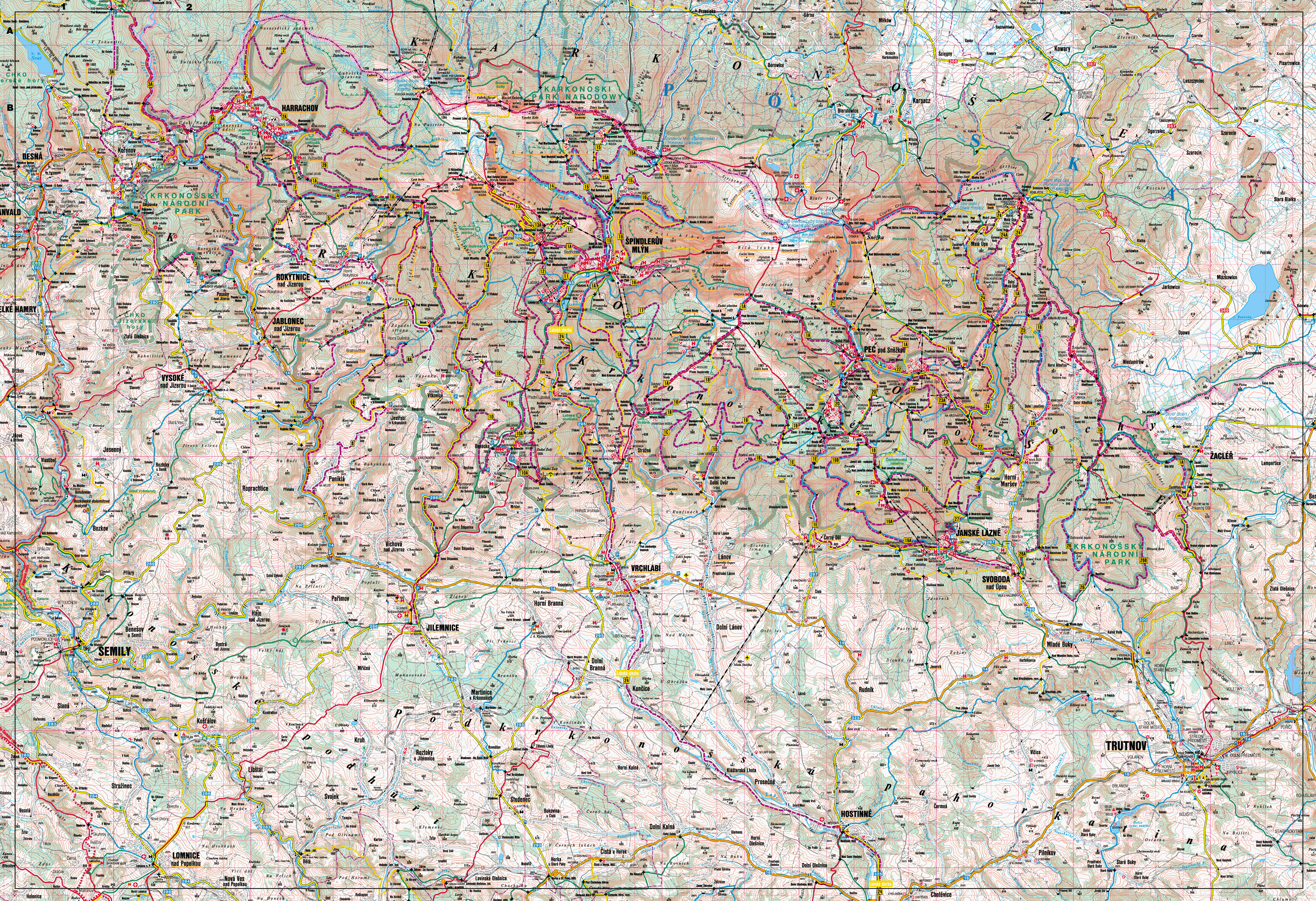
Starting off from Karpacz you can choose one of the few trails going up the Karkonosze Mountains (the highest mountains range of the Sudetes) and following one of them after sometime (depends what trail have you chosen) you reach the highest peak in Karkonosze – Śnieżka (and Sněžka in Czech) 1602 m (5256 ft). Along the main ridge runs Czech-Polish border (as both countries are in Schengen you do not need to worry that you may cross the border). On both sides of the border, large areas of the mountains are designated national parks (the Krkonoše National Park in the Czech Republic and the Karkonosze National Park in Poland), and these together constitute a cross-border biosphere reserve under the UNESCO Man and the Biosphere Program.

1) Silesian Route to Śnieżka (2.5 h – 3 h)
This route starts in Karpacz Biały Jar and runs through:
- Biały Jar (120 min) – there used to be a mine since the Middle Ages until XIX century

- Kopa (15 min)
- Pod Śnieżką Plain (15 min) and Dom Śląski Mountain Shelter

- Śnieżka (30 min)
Silesian Route is no recommended for the winter and spring time.
On the Polish side of the mountain a disc-shaped observatory and restaurant was built in 1974, a weather station and the St. Lawrence chapel. On the Czech side are the remains of the Bohemian hut, a post office, and a chairlift station, connecting the peak with the town of Pec pod Sněžkou at the base of the mountain.
In early 2009 the Polish observatory suffered serious damage to the upper disc as a result of extreme weather and structural failure. Fast response from Technical University of Wrocław saved two remaining disc from taking any further damage. The restaurant and meteo offices were reopened soon after the construction team had finished clearing the debris and securing what was left of the observatory. After detailed expertise it was decided that no further damage should occur and the building will be restored to its previous state.
And here is a view toward western part of Karkonosze, where you will be travelling for next 2-3 hours

And a view toward the Czech Republic

2) Another way to get up the mountain is along a yellow trail starting at the Karpacz train station and going through:
- Wilcza Poręba (20 min)
- Nad Łomniczką mountain shelter, where the red trail joins (75 min)

- Pod Śnieżką Plain, where it joins the previous trail - Silesian Route (20 min)
- Śnieżka (30 min)
This route takes 2h 30min to 2h 45 min and is also closed in the winter.
3) And the third choice – taking from 2h 30min to 3h 20min – easy trail, partially unavailable in the winter and spring but with a diversion, so it is possible to go up the mountains.
- Karpacz Górny
- Polana (80 min)
Down from Śnieżka to Karpacz

Up the way to Śnieżka, The Small Tarn Valley

- Mały Staw (The Small Tarn) Valley and Samotnia Mountain Shelter (40 min)

- Strzecha Akademicka Mountain Shelter (10 min)

- Spalona Strażnica (35 min)
- Dom Śląski Mountain Shelter (25 min)
- Śnieżka (30 min)
Going back down Śnieżka Mountain to the Pod Śnieżką Plain you will now follow the red trail to Szrenica. That may take up to 5h 40min. There are mountain shelters on the way so there is a place to sleep or to stay and eat. Also, this track is considerably easy, you are moving along the main mountain ridge where mountains’ slops are not steep at all, thus the time designed for reaching Szrenica Mountain may be shorter.
... to be continued.


No comments:
Post a Comment